Map - NWKA
Main menu
- Home Page
- Events
- Canal Days
- Map
- Contact
- Pictures
-
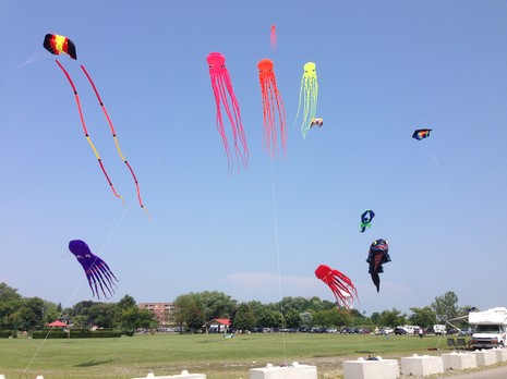
Picture Gallery
- Won't display on Mobile Devices
- Pictures by Jim Anes
- Pictures by Carlos Simoes
- Pictures by Donna Taylor
- Pictures by Walter Corsetti
- Pictures by Ted Shaw
- Pictures by Brendan Burge
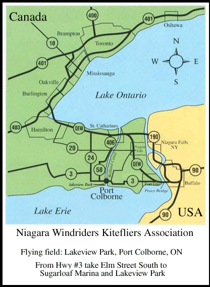
Map
Travelling to Port Colborne, ON
Niagara Windriders Kitefliers Association
Port Colborne is located in the Niagara Peninsula of Southern Ontario, Canada. It lies on the north shore of Lake Erie at the southern terminus of the Welland Canal.
From Buffalo, NY and Fort Erie, ON:
Proceed west on Highway #3 into Port Colborne.
A distance of 32 kilometres (approx. 20 miles) from the Peace Bridge over the Niagara River.
Upon entering Port Colborne you cross a bridge over the Welland Canal.
After crossing the bridge proceed through two stop lights.
Turn left at the third stop light (Elm Street) and proceed due south.
Proceed through two stop lights and one stop street (through downtown Port Colborne).
At the southern end of Elm Street is the entrance to Sugarloaf Harbour Marina and Lakeview Park.
From Welland, ON:
Proceed south along Highway #140 on the east side of the Welland Canal.
At the intersection of Highway #3 turn right.
After crossing the bridge over the Welland Canal proceed through two stop lights.
Turn left at the third stop light (Elm Street) and proceed due south.
Proceed through two stop lights and one stop street (through downtown Port Colborne).
At the southern end of Elm Street is the entrance to Sugarloaf Harbour Marina and Lakeview Park.
From Wainfleet, ON and points west:
Follow Highway #3 east into Port Colborne.
Proceed through the stop lights at the intersection of Highway #58 (McDonald's).
Proceed through the next stop light (Steele Street intersection).
Turn right at the third stop light (Elm Street) and proceed due south.
Proceed through two stop lights and one stop street (through downtown Port Colborne).
At the southern end of Elm Street is the entrance to Sugarloaf Harbour Marina and Lakeview Park.
From the Queen Elizabeth Way in Vineland, ON:
Take the exit for Vineland -
Follow Regional Road #24 south all the way to Wainfleet, ON and the intersection with Highway #3 east.
Follow Highway #3 east into Port Colborne.
Proceed through the stop lights at the intersection of Highway #58 (McDonald's).
Proceed through the next stop light (Steel Street intersection).
Turn right at the third stop light (Elm Street) and proceed due south.
Proceed through two stop lights and one stop street (through downtown Port Colborne).
At the southern end of Elm Street is the entrance to Sugarloaf Harbour Marina and Lakeview Park.
Google Map showing location of HH KNoll Park Port Colborne, Ontario